
LiDAR in your phone uses laser pulses to map your environment in 3D by measuring how long it takes for light to bounce back from surrounding objects. This data creates detailed, real-time maps that help your device understand spatial relationships, even in low light. These maps enhance AR experiences, improve photography, and support navigation. If you keep exploring, you’ll discover how this technology keeps evolving to make your mobile world even smarter.
Key Takeaways
- LiDAR uses laser pulses to measure distances and create detailed 3D maps of the environment in real-time.
- It emits laser signals that bounce off objects, allowing the phone to perceive depth and spatial relationships.
- LiDAR enhances photography, AR, and navigation by providing accurate depth sensing and environment mapping.
- The technology integrates GPS, IMUs, and sensors to precisely locate and orient the device in space.
- Future improvements will enable more immersive AR experiences, better environmental understanding, and autonomous navigation.
What Is LiDAR and How Does It Work?

Ever wondered how autonomous vehicles and topographic maps accurately detect their surroundings? It all comes down to LiDAR technology, which uses laser pulses to create detailed 3D images of the environment. When LiDAR emits laser beams, it measures the time it takes for the light to bounce back, giving precise data for depth perception. This environmental sensing allows vehicles to identify objects, measure distances, and understand their surroundings in real-time. By analyzing the reflected laser signals, LiDAR constructs a detailed map of the environment, helping autonomous systems navigate safely. This combination of accurate depth perception and environmental sensing is what makes LiDAR a crucial tool in modern transportation and mapping applications. Additionally, advancements in energy-efficient cloud infrastructure support the processing and analysis of the vast data generated by LiDAR systems, enhancing real-time decision-making capabilities. Moreover, improvements in laser technology contribute to higher resolution and more accurate environmental scans. The integration of machine learning algorithms further improves the interpretation of LiDAR data, enabling smarter and more adaptable navigation systems.
The Components of a Mobile LiDAR System

A mobile LiDAR system combines several key components to capture detailed 3D environmental data while mounted on a moving platform, such as a vehicle. The core component is the laser scanner, which emits laser pulses and measures their return time to create accurate distance data. Sensors like GPS and inertial measurement units (IMUs) are integrated to help determine precise positioning and orientation, ensuring seamless sensor integration. The system’s electronics manage data collection and processing, balancing performance with power consumption to optimize battery life. A reliable power source supplies energy to all components. Together, these elements work in harmony to produce high-quality spatial data. Efficient sensor integration and power management are essential for the system’s accuracy, responsiveness, and operational endurance during mobile mapping.
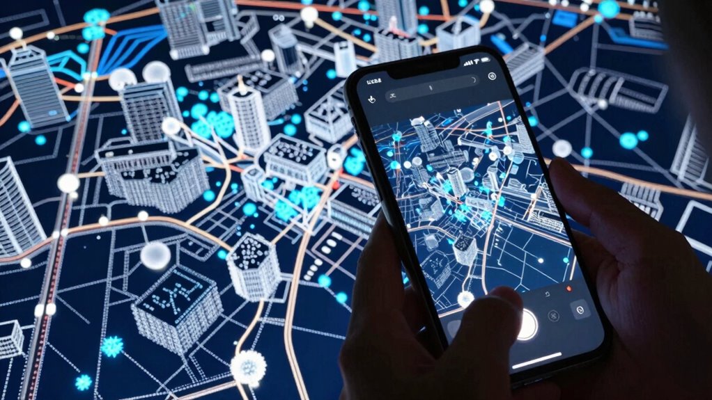
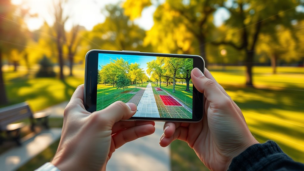
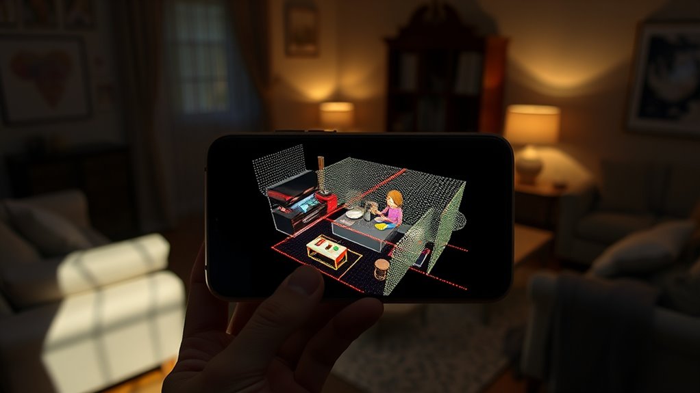
How LiDAR Creates 3D Maps of Your Environment

LiDAR creates detailed 3D maps of your environment by emitting laser pulses that bounce back from surfaces around you. These pulses help your device measure the distance to objects, enhancing depth perception. As the laser beams reflect off different surfaces, the system calculates how long each pulse takes to return, creating a precise map of the surroundings. This process allows you to see a detailed representation of your environment in three dimensions. LiDAR’s ability to detect objects accurately is essential for building reliable maps, even in low-light conditions. By capturing the spatial relationships between objects, your device can construct a thorough 3D model of the scene around you. This detailed mapping forms the foundation for many advanced features in your smartphone’s camera and sensing capabilities. LiDAR’s accuracy plays a crucial role in ensuring the reliability of these detailed environmental scans.
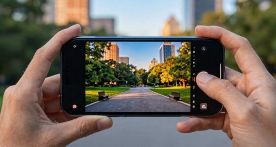
Applications of LiDAR in Modern Smartphones
Have you noticed how modern smartphones can capture stunning photos and navigate your surroundings more intelligently? That’s thanks to LiDAR technology, integrated into your device. It enables advanced applications like improved autofocus, low-light photography, and precise depth sensing. To achieve this, the LiDAR sensor requires meticulous calibration, ensuring accurate distance measurements. Data processing plays a vital role, transforming raw sensor data into detailed 3D maps instantly. This allows your phone to better understand the environment, making features like portrait mode and object detection more reliable. Developers continually refine sensor calibration and data processing algorithms, enhancing performance. As a result, LiDAR makes your smartphone smarter, enabling seamless integration of spatial awareness into everyday functions and immersive experiences. Additionally, ongoing research into sensor calibration techniques ensures even greater accuracy and reliability in future devices. Moreover, advancements in depth sensing algorithms contribute to more precise environmental mapping, improving overall user experience. Continuous improvements in sensor technology promise even more sophisticated capabilities as this technology evolves, with innovative research opening new possibilities for future applications.
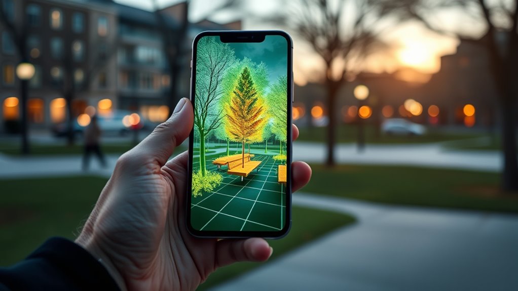
The Benefits of Using LiDAR for Augmented Reality
Ever wondered how augmented reality (AR) experiences feel so seamless and realistic? LiDAR enhances AR by providing accurate depth perception, allowing your device to create detailed 3D maps of your environment. This precise spatial awareness makes virtual objects blend naturally with real-world scenes, increasing immersion. With better depth sensing, you can interact more intuitively with digital elements, whether placing furniture virtually or playing AR games. LiDAR also reduces lag, making experiences smoother and more responsive. As a result, your AR interactions become more engaging and lifelike, boosting both entertainment and practical applications. Overall, LiDAR’s ability to capture the environment in real time elevates AR from simple overlays to fully integrated, interactive experiences that feel genuinely part of your surroundings.
Challenges and Limitations of Mobile LiDAR Technology
While LiDAR greatly enhances augmented reality experiences, mobile versions face notable challenges that can limit their effectiveness. Sensor accuracy varies depending on environmental conditions, like lighting or surface reflectivity, leading to less precise 3D mapping. Additionally, power consumption is a major concern; running the sensor drains your phone’s battery quickly, reducing usability over time. The table below illustrates common limitations:
| Challenge | Impact | Possible Solution |
|---|---|---|
| Sensor accuracy | Less precise depth data in challenging environments | Improved sensors or calibration |
| Power consumption | Shorter device usage due to battery drain | Power-efficient algorithms |
| Environmental factors | Reduced performance outdoors or in bright areas | Enhanced signal processing |
These limitations remind you that mobile LiDAR, while powerful, still has room for improvement. Understanding these challenges can help users set realistic expectations and optimize their device usage.
The Future of LiDAR in Mobile Devices

As LiDAR technology advances in mobile devices, you’ll notice it transforming how you experience augmented reality, making virtual objects more realistic and responsive. It will also enhance your photography by improving depth sensing and low-light performance. Additionally, future smartphones may use LiDAR to support safer autonomous navigation, opening new possibilities for mobility and safety.
Enhanced Augmented Reality
Enhanced augmented reality (AR) is set to become more immersive and accurate thanks to advancements in LiDAR technology on mobile devices. You’ll experience more precise depth sensing, allowing virtual objects to blend seamlessly with real-world environments. As environmental mapping improves, your device can better understand spatial layouts, making AR interactions more realistic and responsive. This means virtual elements will stay anchored accurately, even as you move around. LiDAR’s ability to quickly gather detailed 3D data enhances your AR experiences, whether for gaming, navigation, or interior design. With better environmental mapping, virtual objects won’t just appear in your space—they’ll interact naturally with the surroundings, creating a more convincing and engaging augmented reality experience.
Improved Photography Capabilities
LiDAR technology on mobile devices is poised to revolutionize photography by enabling faster, more accurate depth sensing. With improved depth sensing, your phone can better separate subjects from backgrounds, creating more natural bokeh effects and sharper images. This precise depth information also enhances low light imaging, allowing your device to capture clearer photos in dim environments. LiDAR helps your camera quickly analyze scenes, reducing blur and increasing detail even in challenging lighting conditions. As a result, photo quality improves markedly, with more vibrant colors and better contrast. Whether you’re taking portraits or capturing landscapes, LiDAR’s contribution to depth sensing and low light imaging ensures your mobile photos are more professional and true-to-life, pushing the boundaries of mobile photography further than ever before.
Advancements in Autonomous Navigation
Advancements in autonomous navigation are set to transform the way mobile devices interpret and interact with their surroundings. With improved robotic mapping and terrain analysis, your phone will better understand complex environments, making navigation smarter and safer. Imagine walking through crowded streets or rough terrains, and your device seamlessly guiding you without hesitation. These innovations will empower your device to:
- Precisely map your environment in real-time, enhancing safety.
- Detect obstacles instantly, reducing accidents.
- Navigate complex terrains confidently, even off-road.
- Support autonomous features that adapt to changing surroundings.
LiDAR’s role in autonomous navigation *liberates* a future where your phone acts more like a smart companion, capable of understanding and responding to the world around you with accuracy and confidence.
Frequently Asked Questions
How Accurate Is Mobile Phone Lidar Compared to Professional Systems?
Your phone’s LiDAR is quite accurate for casual use, but it doesn’t match professional systems. It relies on sensor calibration and advanced software algorithms to improve precision, yet it still has limitations. Professional LiDAR uses higher-grade sensors and meticulous calibration, resulting in centimeter-level accuracy. For everyday applications like AR or measuring rooms, your phone works well, but for detailed surveying or engineering tasks, professional systems are much more reliable.
Can Lidar Work Effectively in Low-Light or Dark Environments?
Think of your phone’s LiDAR as a night vision superhero, capable of working in dark environments. It beams out laser pulses that bounce back from obstacles, enabling effective obstacle detection even in low-light or pitch-black settings. While not as powerful as professional night vision gear, it still paints a detailed 3D map of your surroundings, ensuring you can navigate confidently through darkness, much like a bat using echolocation.
How Does Weather Affect Lidar Performance on Smartphones?
Weather can impact your phone’s LiDAR performance by causing signal interference, especially in fog, rain, or snow. These conditions scatter the laser signals, reducing accuracy and range. Additionally, adverse weather may affect sensor calibration, leading to less reliable data. You might notice your device struggles to capture precise 3D scans or distances, making it essential to use LiDAR in clearer conditions for the best results.
What Are the Privacy Implications of Using Lidar on Phones?
Using LiDAR on your phone raises privacy concerns because it collects detailed spatial data, which could compromise data privacy if misused. You need to be aware of data security measures, like encryption and permissions, that safeguard your information. Always review app settings and permissions to control who accesses your LiDAR data. By staying vigilant, you help ensure your privacy remains intact while enjoying the benefits of advanced 3D sensing.
Will Lidar Significantly Impact Smartphone Battery Life?
LiDAR can impact your smartphone’s battery life, but manufacturers focus on energy efficiency to minimize this. When you use LiDAR features, expect increased battery consumption because the sensor actively scans your surroundings. However, modern phones optimize power management, so the impact remains manageable during regular use. If you’re concerned about battery drain, limit LiDAR usage or enable power-saving modes, ensuring your device remains efficient while benefiting from 3D sensing.
Conclusion
As you explore your phone’s 3D world, remember that LiDAR can create detailed maps in milliseconds. Did you know over 70% of new smartphones now include LiDAR sensors? This technology not only enhances your augmented reality experiences but also shapes future innovations. As mobile LiDAR continues to evolve, it will become even more integral to your daily life, making interactions more immersive and seamless than ever before.