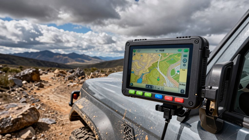

When choosing an overlanding GPS navigator, ruggedness and reliability are non-negotiable. The Garmin Tread XL stands out as the best overall pick for its comprehensive all-terrain features and durable build. For those needing satellite communication, the Garmin GPSMAP 67i offers robust safety tools, while the Garmin eTrex 32x balances affordability with durability. The main tradeoffs involve balancing advanced features against ease of use and price. Keep reading to see how each model stacks up for your next adventure.

Get the latest gadgets delivered free with Prime
- Fast, free delivery on millions of items
- Prime Video, Amazon Music and more included
- Member-only deals all year
Complete the kit


Key Takeaways
- The top models combine durability with advanced navigation features tailored for off-road use.
- Battery life and screen readability in direct sunlight are critical factors for extended overlanding trips.
- Satellite communication and safety features are more prevalent among higher-end options like the Garmin GPSMAP 67i.
- Compact handheld units often trade off some screen size and advanced mapping for portability and ease of use.
- Pricing varies widely, with premium models offering extensive features, but budget options can still deliver rugged performance.
| Garmin Tread XL Overland All-Terrain Navigator |  | Best Overall Rugged Overlanding GPS | Display: 10-inch ultrabright | Water Resistance: IP67 | Maps: Preloaded topographic and satellite imagery | VIEW ON AMAZON | See Our Full Breakdown |
| Garmin GPSMAP 67i Rugged Handheld GPS with inReach Satellite, Two-Way Messaging, SOS, Mapping (Renewed) |  | Best Rugged Handheld with Global Satellite Communication | Display: 3 inches | Water Resistance: Rugged, weatherproof | Maps: Preloaded TopoActive | VIEW ON AMAZON | See Our Full Breakdown |
| Garmin eTrex 32x Rugged Handheld GPS Navigator |  | Best Budget Rugged Handheld for Outdoor Activities | Display: 2.2 inches | Water Resistance: Yes | Maps: Preloaded TopoActive | VIEW ON AMAZON | See Our Full Breakdown |
| Handheld GPS for Hiking, Waterproof and Rugged with 3.2″ Sunlight Readable Screen, USA Topo Map, Multi-GNSS Support, Extra Battery Life |  | Best Compact Rugged GPS for Hikers and Campers | Display: 3.2 inches | Water Resistance: Waterproof | Maps: Preloaded USA Topo | VIEW ON AMAZON | See Our Full Breakdown |
| Garmin eTrex 32x Rugged Handheld GPS Navigator (Renewed) |  | Best Reliable Budget Rugged GPS | Display: 2.2 inches | Water Resistance: Yes | Maps: Preloaded Topo Active | VIEW ON AMAZON | See Our Full Breakdown |
| Garmin Tread® 2 – Overland Edition Rugged All-Terrain Navigator |  | Best Overall for Off-Road and Overlanding Enthusiasts | Screen size: 8 inches | Display: High-resolution, ultrabright, glove-friendly touchscreen | Water resistance: IP67 | VIEW ON AMAZON | See Our Full Breakdown |
| Garmin eTrex SE GPS Handheld Navigator |  | Best for Long-Duration, Compact Outdoor Adventures | Display: 2.2-inch high-resolution | Battery Life: Up to 168 hours | Water Resistance: IPX7 | VIEW ON AMAZON | See Our Full Breakdown |
| Garmin Tread® 2 – SxS Edition Rugged 8″ All-Terrain Navigator |  | Best for Extreme Off-Road and Side-by-Side Use | Display: 8-inch high-resolution touchscreen | Water Resistance: IP67 | Mounting: Tube mount kit included | VIEW ON AMAZON | See Our Full Breakdown |
| Garmin eTrex 22x Rugged Handheld GPS Navigator, Black/Navy |  | Best for Basic, Reliable Outdoor Navigation | Display: 2.2 inches | Display Resolution: 240 x 320 | Map Types: Topographical | VIEW ON AMAZON | See Our Full Breakdown |
| Garmin eTrex Touch Rugged Essential GPS Handheld Navigator |  | Best Compact Touchscreen for Versatile Outdoor Use | Display: 3-inch high-resolution | Water Rating: IP67 | Map Support: Preloaded with roads and trails, optional Outdoor Maps+ | VIEW ON AMAZON | See Our Full Breakdown |
| overlanding gps navigators rugged | Display | Water Resistance | Battery Life | Maps |
|---|---|---|---|---|
| Garmin Tread XL Overland All-T | 10-inch ultrabright | IP67 | Variable, depending on usage | Preloaded topographic and satellite imagery |
| Garmin GPSMAP 67i Rugged Handh | 3 inches | Rugged, weatherproof | Up to 165 hours | Preloaded TopoActive |
| Garmin eTrex 32x Rugged Handhe | 2.2 inches | Yes | Up to 25 hours | Preloaded TopoActive |
| Handheld GPS for Hiking | 3.2 inches | Waterproof | 36 hours | Preloaded USA Topo |
| Garmin eTrex 32x Rugged Handhe | 2.2 inches | Yes | Up to 25 hours | Preloaded Topo Active |
| Garmin Tread® 2 | High-resolution, ultrabright, glove-friendly touchscreen | IP67 | — | Preloaded topographic maps of North and South America, City Navigator |
| Garmin eTrex SE GPS Handheld N | 2.2-inch high-resolution | IPX7 | Up to 168 hours | — |
| Garmin Tread® 2 | 8-inch high-resolution touchscreen | IP67 | — | OpenStreetMap, US Forest Service, Outdoor Maps+" subscription |
| Garmin eTrex 22x Rugged Handhe | 2.2 inches | — | Up to 25 hours | — |
| Garmin eTrex Touch Rugged Esse | 3-inch high-resolution | — | Up to 650 hours | — |
More Details on Our Top Picks
Garmin Tread XL Overland All-Terrain Navigator
This model stands out for its massive 10-inch ultrabright display, making it ideal for off-road environments where visibility is critical. Compared with the Garmin GPSMAP 67i, the Tread XL offers a larger screen, which enhances map readability during challenging terrains, but it requires an active subscription for satellite features, adding ongoing costs. Its preloaded topographic maps and built-in satellite communication make it perfect for self-sufficient adventures. However, the device’s bulk and higher price tag may be a concern for those seeking a lightweight option. Its rugged build and weather resistance mean it can withstand tough conditions, making it a versatile choice for serious overlanders who prioritize visibility and connectivity in remote areas.
Pros:- Large 10-inch ultrabright display for easy viewing
- Preloaded topographic maps and POIs for camping and trails
- Built-in inReach satellite communication for global connectivity
- Weather-resistant and rugged design
Cons:- Requires a subscription for inReach satellite features
- Heavy and bulky for extended carry or backpacking
Best for: Overlanders who need a large, rugged device with comprehensive off-road features and satellite connectivity.
Not ideal for: Lightweight travelers or casual campers who prefer smaller, less expensive GPS units without advanced satellite features.
- Display:10-inch ultrabright
- Water Resistance:IP67
- Maps:Preloaded topographic and satellite imagery
- Connectivity:Built-in inReach, Bluetooth
- Additional Features:Altimeter, barometer, compass
- Battery Life:Variable, depending on usage
Our verdict“This is best suited for serious overlanding enthusiasts needing a large, rugged device with advanced communication features.”
Garmin GPSMAP 67i Rugged Handheld GPS with inReach Satellite, Two-Way Messaging, SOS, Mapping (Renewed)
Compared with the Garmin eTrex 32x, the GPSMAP 67i offers a more rugged build and a more powerful satellite communication system, making it ideal for remote expeditions. Its 3-inch sunlight-readable display provides clear visuals, though it’s smaller than the Tread XL’s screen, which can limit map detail. The device’s long battery life of 165 hours and global Iridium satellite connectivity make it a reliable companion for extended trips in challenging environments. However, the need for an active subscription and limited internal storage (16 GB) may be drawbacks for budget-conscious users or those with extensive map needs. Overall, this pick emphasizes durability and communication, perfect for adventurers who prioritize safety and connectivity over screen size.
Pros:- Global Iridium satellite communication for messaging and SOS
- Highly durable and weather-resistant design
- Long battery life for extended expeditions
- Preloaded topographic maps
Cons:- Requires active satellite subscription
- Limited internal storage may necessitate microSD cards
Best for: Extreme outdoor enthusiasts requiring reliable satellite communication and durability in remote locations.
Not ideal for: Casual campers or those seeking a large display, who might prefer the Garmin Tread XL or similar models.
- Display:3 inches
- Water Resistance:Rugged, weatherproof
- Maps:Preloaded TopoActive
- Battery Life:Up to 165 hours
- Satellite:Iridium
- Connectivity:Bluetooth, USB
Our verdict“This device is perfect for remote explorers needing dependable satellite communication and rugged durability, with less focus on screen size.”
Garmin eTrex 32x Rugged Handheld GPS Navigator
Compared with the Garmin GPSMAP 67i, the eTrex 32x offers a more affordable option with solid durability for hiking and cycling. Its 2.2-inch sunlight-readable display may be smaller, but it’s highly portable and easy to operate with physical buttons, especially suited for quick navigation in tough conditions. Supporting both GPS and GLONASS, it provides reliable signal tracking, though with less advanced communication features. Its 8 GB of internal storage is the main limiting factor, making microSD expansion almost necessary for extensive mapping. For those who prioritize simplicity and cost-effectiveness in rugged environments, this device strikes a good balance, though it doesn’t support satellite messaging or SOS functions.
Pros:- Rugged, weatherproof design
- Supports GPS and GLONASS for reliable tracking
- Long battery life of up to 25 hours
- Preloaded with detailed topographic maps
Cons:- Small display size can be challenging in bright sunlight
- Limited internal storage, requiring microSD expansion
Best for: Budget-conscious outdoor lovers seeking a durable, straightforward GPS for hiking and cycling.
Not ideal for: Remote explorers needing satellite communication or large screens for detailed mapping.
- Display:2.2 inches
- Water Resistance:Yes
- Maps:Preloaded TopoActive
- Battery Life:Up to 25 hours
- Supported Satellite Systems:GPS and GLONASS
- Memory Storage:8 GB
Our verdict“Ideal for those who need a tough, affordable GPS that handles outdoor adventures without complex features.”
Handheld GPS for Hiking, Waterproof and Rugged with 3.2″ Sunlight Readable Screen, USA Topo Map, Multi-GNSS Support, Extra Battery Life
Compared with the Garmin eTrex 32x, this GPS emphasizes a larger 3.2-inch sunlight-readable display and longer battery life, making it more suitable for extended outdoor activities. Its physical buttons ensure operation in any weather, while the multi-GNSS support enhances positional accuracy in challenging terrains. Although it lacks a touchscreen, the bright display and rugged build make it easier to read and operate outdoors. Internal storage of 32 GB is generous, accommodating extensive maps, but it’s less feature-rich in terms of satellite communication, making it less suitable for remote SOS needs. This device best suits hikers and campers who prioritize ease of use, long battery life, and clarity in rugged environments.
Pros:- Large, sunlight-readable 3.2-inch display
- Long battery life up to 36 hours
- Supports multiple GNSS systems for high accuracy
- Waterproof and rugged design
Cons:- No touchscreen functionality
- Requires USB-C for charging
Best for: Hikers and campers needing a durable, easy-to-operate GPS with a large readable screen.
Not ideal for: Remote adventurers requiring satellite messaging or advanced communications in isolated areas.
- Display:3.2 inches
- Water Resistance:Waterproof
- Maps:Preloaded USA Topo
- Battery Life:36 hours
- GNSS Support:Multi-GNSS
- Storage:32 GB
Our verdict“This pick is ideal for outdoor enthusiasts who need a rugged, easy-to-read device for extended hikes and camping trips.”
Garmin eTrex 32x Rugged Handheld GPS Navigator (Renewed)
Similar to the non-renewed eTrex 32x, this device offers dependable performance at a lower cost, making it attractive for budget-conscious outdoor users. Its 2.2-inch display may be smaller than the Handheld GPS for Hiking, but it retains the core features like support for GPS and GLONASS, preloaded Topo Active maps, and a 3-axis compass with barometric altimeter. Its durability and long battery life of up to 25 hours make it suitable for hiking and cycling in demanding environments. The limited internal storage of 8 GB remains a constraint if extensive maps are needed, but microSD support offers a potential solution. This unit suits those who want reliable rugged navigation without extra bells and whistles, accepting some compromises in display size and features.
Pros:- Rugged and weatherproof design
- Supports GPS and GLONASS for reliable positioning
- Preloaded detailed topo maps
- Long battery life
Cons:- Small display size limits ease of use in bright sunlight
- Limited internal storage without microSD expansion
Best for: Budget-minded outdoor explorers seeking a durable, basic GPS with essential navigation features.
Not ideal for: Users needing a large screen or advanced communication features for remote expeditions.
- Display:2.2 inches
- Water Resistance:Yes
- Maps:Preloaded Topo Active
- Battery Life:Up to 25 hours
- Supported Satellite Systems:GPS and GLONASS
- Storage:8 GB
Our verdict“This is a dependable, affordable choice for outdoor adventurers who prioritize durability and basic navigation features.”
Garmin Tread® 2 – Overland Edition Rugged All-Terrain Navigator
The Garmin Tread® 2 Overland Edition stands out for its comprehensive mapping suite, including preloaded topographic and satellite imagery, making it ideal for serious off-roaders. Its large, glove-friendly 8-inch display offers clear visuals even in extreme weather, and the rugged IP67 rating ensures durability in harsh conditions. Compared with the SxS Edition, this model excels in vehicle routing and trip planning, but the broader feature set comes with a steeper learning curve and a higher price. Its support for vehicle electronics control adds convenience, yet subscription fees for premium maps can add up. This device is best suited for overlanding pros needing detailed navigation and vehicle integration, despite its complexity and cost.Pros:- Rugged design with IP67 rating for extreme weather conditions
- Large, high-resolution glove-friendly touchscreen
- Comprehensive mapping including topographic and satellite imagery
- Supports vehicle electronics control via companion app
Cons:- Premium map subscriptions are costly
- Feature-rich interface may require significant time to master
Best for: Experienced overlanders and vehicle-focused explorers seeking advanced features and rugged durability
Not ideal for: Casual hikers or beginners who prefer simpler devices without vehicle integration or extensive map options
- Screen size:8 inches
- Display:High-resolution, ultrabright, glove-friendly touchscreen
- Water resistance:IP67
- Maps:Preloaded topographic maps of North and South America, City Navigator
- Satellite imagery:Download subscription-free high-resolution overhead views
- Connectivity:Wi-Fi, Bluetooth
Our verdict“This pick is perfect for seasoned overlanders who need robust, feature-packed navigation with vehicle control capabilities.”
Garmin eTrex SE GPS Handheld Navigator
The Garmin eTrex SE offers an excellent balance of ruggedness and battery life, making it ideal for extended trips where weight and power are concerns. Its 2.2-inch high-resolution display is small but clear enough for basic navigation, especially when paired with the Garmin Explore app for planning and updates. Unlike the larger Tread models, it doesn’t support advanced vehicle routing but compensates with up to 168 hours of battery life—perfect for multi-day expeditions. However, it relies on two AA batteries which are not included, and its limited internal mapping means users will need to carry additional SD cards for detailed maps. This device is best for backpackers or hunters prioritizing portability and battery longevity, even if it sacrifices some ease of use and map detail.Pros:- Long battery life up to 168 hours in standard mode
- Multi-GNSS support for reliable positioning in remote areas
- Water-resistant (IPX7) for all-weather use
- Supports wireless updates via Garmin Explore app
Cons:- Requires 2 AA batteries, not included
- Small display limits detailed viewing
Best for: Backcountry explorers, hunters, and hikers needing a durable, long-lasting GPS
Not ideal for: Users seeking detailed onboard maps or touchscreen interfaces, as it relies on physical buttons and basic mapping
- Display:2.2-inch high-resolution
- Battery Life:Up to 168 hours
- Water Resistance:IPX7
- Support:Multi-GNSS (GPS, GLONASS, Galileo, BeiDou, QZSS)
- Features:Digital compass, geocache support
- Connectivity:Wireless with Garmin Explore app
Our verdict“This model is best for those who need dependable, long-lasting navigation in rugged environments without the bulk of larger units.”
Garmin Tread® 2 – SxS Edition Rugged 8″ All-Terrain Navigator
The Garmin Tread® 2 SxS Edition emphasizes durability and detailed off-road mapping, making it a prime choice for side-by-sides and ATV riders tackling rugged terrains. Its 8-inch high-res touchscreen is glove-compatible, and the inclusion of sensors like altimeter, barometer, and compass adds valuable data for off-road navigation. It supports detailed map sources such as OpenStreetMap and US Forest Service data, but some features require a subscription, and additional accessories like the Group Ride Radio are sold separately. Compared to the Overland Edition, this model leans more towards extreme terrain riders, sacrificing some vehicle-centric features for terrain-specific data. This device is ideal for off-roaders who need high-resolution, sensor-rich mapping on extreme terrains, despite the extra cost for premium maps and accessories.Pros:- Rugged IP67 rated construction withstands extreme weather
- High-resolution, glove-friendly 8-inch display
- Supports detailed maps, satellite imagery, and elevation data
- Includes sensors like altimeter, barometer, compass for terrain awareness
Cons:- Premium maps require a subscription, increasing ongoing costs
- Some map data limitations for certain routes
Best for: Off-road riders, ATV enthusiasts, and extreme terrain explorers needing detailed elevation and land info
Not ideal for: Casual road travelers or urban users, as its features are tailored for off-road adventures
- Display:8-inch high-resolution touchscreen
- Water Resistance:IP67
- Mounting:Tube mount kit included
- Maps:OpenStreetMap, US Forest Service, Outdoor Maps+” subscription
- Additional Features:Digital elevation, land info, campgrounds, sensors
- Connectivity:Wi-Fi, Bluetooth, cellular
Our verdict“This pick suits off-roaders seeking sensor-rich, high-res navigation in the toughest terrains, at a higher price point.”
Garmin eTrex 22x Rugged Handheld GPS Navigator, Black/Navy
The Garmin eTrex 22x delivers durability and essential navigation features at a lower price point, making it suitable for outdoor enthusiasts who don’t need a touchscreen or complex interfaces. Its 2.2-inch display is small but easily viewable in sunlight, and preloaded Topo Active maps provide sufficient detail for most outdoor activities. Its support for GPS and GLONASS enhances positioning accuracy in challenging environments. Compared to the more advanced models like the Tread series, it lacks advanced vehicle routing and satellite imagery, but its rugged design and long battery life of 25 hours make it reliable for extended use. The limited internal storage and small display mean it’s less suitable for users who want detailed maps on the device itself. This device makes sense for hikers and hunters who need a straightforward, durable unit with decent mapping, even if it doesn’t support extensive onboard mapping or large screens.Pros:- Rugged, durable design suitable for tough conditions
- Preloaded with detailed Topo Active maps
- Supports GPS and GLONASS for accurate tracking
- Long battery life of up to 25 hours
Cons:- Small display limits detailed map viewing
- No touchscreen, relies on physical buttons
Best for: Backcountry hikers, hunters, and outdoor adventurers seeking straightforward, durable navigation
Not ideal for: Users who want a large display or advanced mapping capabilities, as it relies on physical buttons and basic maps
- Display:2.2 inches
- Display Resolution:240 x 320
- Map Types:Topographical
- Memory Storage Capacity:8 GB
- Battery Life:Up to 25 hours
- Supported Satellite Systems:GPS and GLONASS
Our verdict“This model fits outdoor explorers who prefer simple, rugged navigation with reliable battery life and basic mapping.”
Garmin eTrex Touch Rugged Essential GPS Handheld Navigator
The Garmin eTrex Touch offers a compact yet capable solution for outdoor enthusiasts who want a bright, high-res color touchscreen. Its 3-inch display improves usability over smaller devices, and the rugged IP67 rating ensures it withstands rain and dust. With preloaded maps for roads and trails, it caters well to hikers and mountain bikers, especially those who value route planning on a bright display. While it supports multi-band GPS for higher accuracy, additional maps require the optional Outdoor Maps+ plan, adding to the overall cost. Compared to the larger Tread models, the eTrex Touch sacrifices some advanced vehicle features for portability. This device is best for those seeking a versatile, rugged handheld with a clear display for varied outdoor activities, but less ideal for users needing extensive onboard maps or large screens.Pros:- Bright, sunlight-readable 3-inch touchscreen
- Rugged IP67-rated construction
- Supports multi-band GPS with SatIQ technology for high accuracy
- Long battery life up to 650 hours in expedition mode
Cons:- Additional maps require separate purchase
- Limited internal storage for maps
Best for: Hikers, mountain bikers, and outdoor explorers requiring a rugged, portable touchscreen GPS
Not ideal for: Users needing detailed onboard maps or large screen navigation for complex routes, as it relies on external map purchases
- Display:3-inch high-resolution
- Water Rating:IP67
- Map Support:Preloaded with roads and trails, optional Outdoor Maps+
- GPS Support:Multi-band GPS with SatIQ
- Battery Life:Up to 650 hours
- Mounting:Integrated Spine Mount
Our verdict“This pick suits outdoor adventurers who want a rugged, portable touchscreen with reliable multi-band GPS and decent mapping options.”

How We Picked
The products in this roundup were selected based on their ruggedness, durability, and suitability for overlanding conditions. We evaluated each device’s build quality, screen visibility in sunlight, battery life, and connectivity options, including satellite features. Usability in remote environments and ease of map updates also played a role. Our ranking favors models that deliver reliable performance in harsh terrains while balancing value and feature set, helping users find the best fit for their specific needs.| overlanding gps navigators rugged | Water Resistance | Maps | Connectivity |
|---|---|---|---|
| Garmin Tread XL Overland All-T | IP67 | Preloaded topographic and satellite imagery | Built-in inReach, Bluetooth |
| Garmin GPSMAP 67i Rugged Handh | Rugged, weatherproof | Preloaded TopoActive | Bluetooth, USB |
| Garmin eTrex 32x Rugged Handhe | Yes | Preloaded TopoActive | — |
| Handheld GPS for Hiking | Waterproof | Preloaded USA Topo | — |
| Garmin eTrex 32x Rugged Handhe | Yes | Preloaded Topo Active | — |
| Garmin Tread® 2 | IP67 | Preloaded topographic maps of North and South America, City Navigator | Wi-Fi, Bluetooth |
| Garmin eTrex SE GPS Handheld N | IPX7 | — | Wireless with Garmin Explore app |
| Garmin Tread® 2 | IP67 | OpenStreetMap, US Forest Service, Outdoor Maps+" subscription | Wi-Fi, Bluetooth, cellular |
| Garmin eTrex 22x Rugged Handhe | — | — | — |
| Garmin eTrex Touch Rugged Esse | — | — | — |
Factors to Consider When Choosing Overlanding Gps Navigators Rugged
Choosing the right overlanding GPS navigator involves balancing durability, features, and usability. It’s essential to consider how ruggedness aligns with your typical terrain and climate, as well as how much advanced functionality you need versus simplicity. Battery life and screen readability are key for long trips, while safety features like satellite communication can be lifesaving. Understanding these factors helps avoid common pitfalls, such as overpaying for unnecessary features or choosing a device that isn’t durable enough for your environment.Durability and Ruggedness
A rugged overlanding GPS must withstand shocks, water, dust, and extreme temperatures. Look for MIL-STD-810G certification or IP ratings that match your environment. Cheaper models may claim ruggedness but often lack real-world durability, so prioritize trusted brands like Garmin with proven build quality. Remember, a durable device is less likely to fail in critical moments, but it can also be heavier or bulkier, so consider your portability needs.Screen Visibility and Size
Clear visibility in direct sunlight is vital for off-road use, so opt for screens with high brightness and anti-glare coatings. Larger screens provide more detail but can compromise portability, while smaller screens are easier to handle but may limit map detail. Many premium models incorporate sunlight-readable displays, which are worth the investment for prolonged outdoor use. Think about your typical use case—do you need detailed maps on a large screen or a lightweight device for quick glances?Battery Life and Power Options
Extended trips demand long battery life, especially when access to charging may be limited. Devices with larger batteries or low-power modes are preferable. Some models support external power sources or solar charging, which can be game-changers on multi-day adventures. Beware of devices that drain batteries quickly or require frequent recharging, as this can limit your operational time in remote areas.Navigation Features and Compatibility
Robust mapping options, multi-GNSS support, and offline capabilities are essential for overlanding. Compatibility with topographic maps, trail data, and user-generated content enhances navigation. Devices with two-way messaging or SOS features add safety but may come at a higher cost. Assess your technical comfort level—some models are more user-friendly, while others offer advanced customization for experienced users.Safety and Communication Tools
Satellite communication, emergency SOS, and two-way messaging are vital for remote expeditions. Higher-end models like the Garmin GPSMAP 67i integrate these features seamlessly. Cheaper options might lack these safety tools, which could be a risk if you venture far from cell coverage. Weigh the importance of safety features based on your typical routes and the level of risk involved.Frequently Asked Questions
Is a larger screen always better for off-road navigation?
While a larger screen can display more detailed maps, it also adds bulk and weight, which might affect portability. For extended overlanding trips, a balance between screen size and device weight is crucial. Some users prefer compact units for ease of handling, especially in tight spaces or when mounted on vehicles. Ultimately, the best choice depends on whether you prioritize detailed visuals or lightweight convenience.
Do I really need satellite communication features for overlanding?
Satellite communication and emergency SOS are invaluable safety tools, especially when venturing into remote areas with no cell coverage. They allow you to call for help or send messages in emergencies, which can be a literal lifesaver. However, these features often come with additional costs and complexity. If your trips stay within well-traveled routes, simpler GPS models might suffice, but safety-minded explorers should consider devices with satellite capabilities.
How important is map update frequency in rugged GPS devices?
Frequent map updates ensure your navigation data remains accurate, especially with changing trail conditions or new routes. Many rugged devices support regular updates via Wi-Fi or SD cards. Outdated maps can lead to navigation errors or missed routes, which is risky in remote areas. Consider the update process and costs involved when choosing a device, especially if you rely heavily on the latest trail information.
Can I use a handheld GPS for off-road vehicle navigation?
Yes, handheld GPS units are often rugged and suitable for vehicle use, but their smaller screens may limit detailed visualization. Dedicated vehicle-mounted units or larger all-terrain navigators tend to offer better visibility and integration with vehicle systems. If you prefer portability and multi-purpose use, handheld units work well, but for dedicated off-road driving, a larger, vehicle-specific device might be more practical.
Are more expensive rugged GPS units worth the extra investment?
Higher-priced models usually come with enhanced durability, longer battery life, better screens, and advanced safety features. These are worth considering if you spend extended periods in harsh environments or rely on safety tools. However, for casual or shorter trips, mid-range devices can provide sufficient performance at a lower cost. Carefully evaluate your trip frequency and safety needs to determine if the premium options justify their higher price.
Conclusion
For the most demanding overlanding adventures where durability and safety are priorities, the Garmin Tread XL stands out as the best overall choice, thanks to its comprehensive feature set and rugged build. Budget-conscious explorers and those new to overlanding will find the Garmin eTrex 32x offers solid performance without breaking the bank, making it ideal for beginners. For users needing satellite communication and emergency features, the Garmin GPSMAP 67i delivers peace of mind, though at a higher cost. Serious off-road enthusiasts looking for a premium, feature-rich device should consider the Garmin Tread 2 – SxS Edition. Ultimately, your choice should match your trip length, safety requirements, and budget to ensure your adventures are both exciting and safe.
As an affiliate, we earn on qualifying purchases.Halloween Picks
halloween