
TL;DR

Get the latest gadgets delivered free with Prime
- Fast, free delivery on millions of items
- Prime Video, Amazon Music and more included
- Member-only deals all year
Google says a three-year partnership with Ignite Energy Access has used mapping, routing and satellite-analysis tools to address barriers to off-grid solar delivery in sub-Saharan Africa. Google estimates the work enabled more than 160,000 tonnes of carbon-dioxide-equivalent emissions reductions in the first half of 2026; it attributes the result to 3.7 million solar devices delivered across the region since 2023. The emissions estimate and the models’ performance are company-reported, and the source does not provide independent verification.
Google said its three-year partnership with Ignite Energy Access has supported the delivery of 3.7 million solar devices across sub-Saharan Africa since 2023, and that the work enabled an estimated more than 160,000 tonnes of CO2-equivalent reductions in the first half of 2026. The collaboration uses mapping, routing and satellite-image analysis to address practical obstacles to reaching households beyond electricity grids, though Google presented the emissions figure as its own estimate.
In a report dated October 26, 2026, Google described work with Ignite through its Startups for Sustainable Development program. The companies held more than 100 advisory sessions over three years, bringing together researchers, engineers and data specialists to work on locating households without formal addresses and planning deliveries over rural routes. Ignite is described by Google as an off-grid energy company with an ambition to connect 100 million people in Africa by 2030; that figure is a company goal, not a reported result.
The teams combined satellite imagery with Google’s Open Buildings dataset and routing algorithms to identify homes missing from standard mapping services. Google also said researchers are developing geospatial models to identify rural paths and include them in routing, while operations-research models help Ignite evaluate warehouse and local mini-hub locations. The models weigh factors including transport costs, vehicle capacity, delivery routes and inventory expenses.
For deployment planning, Google researchers are developing computer-vision models to identify small rooftop solar installations in satellite imagery. Google said the panels can appear as roughly a single pixel in standard images, making them difficult to detect at scale. The team is testing model variations using Gemini for Science and drone imagery supplied by Ignite as ground-truth data. The report did not publish accuracy results or say the mapping system is already operating across the region.
Reaching Homes Beyond Power Lines
The work addresses a last-mile problem in energy access: households outside formal grids may be distant from roads and absent from conventional maps, while small solar panels can be hard to spot from space. Better household and route data could help providers decide where to deliver equipment and where new service is needed, although the report does not quantify how much the tools have reduced delivery times or costs.
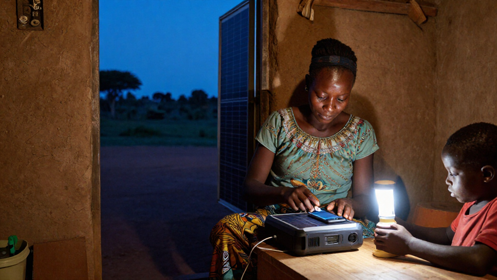
The scale of need is substantial. Google’s report says more than 600 million people in sub-Saharan Africa live without electricity, and describes households relying on kerosene and candles for basic lighting. Off-grid solar can provide electricity without waiting for grid expansion, but the company’s reported device deliveries and emissions estimate do not by themselves establish how many people gained reliable power or how long systems remain in use.
The collaboration is also looking beyond lighting. Google says the partners are modeling community micro-grids that could supply enough power for electric cooking, which requires more energy than an individual rooftop kit can provide. That work could broaden the potential benefits from household lighting to cooking and indoor air quality, but it remains a planning effort rather than a reported deployment.
Products Worth Considering

Jackery Explorer 300 Portable Power Station, 292Wh

Anker SOLIX C200 DC Portable Power Station, 192Wh, 200W

Bose SoundLink Flex Bluetooth Speaker (2nd Gen), Portable Waterproof Speaker, Black
As an affiliate, we earn on qualifying purchases.
How the Three-Year Partnership Works
Google frames the collaboration as a response to three linked barriers: locating homes without formal addresses, moving solar hardware over difficult rural terrain, and identifying existing installations with satellite imagery. The company says the partnership began through its Startups for Sustainable Development program and has focused on data and logistics for Ignite’s work beyond Google’s own operational footprint.
The delivery and mapping efforts serve different purposes. Household and path maps can support field teams and supply-chain planning; satellite detection could help identify where solar systems are already installed and where underserved communities may remain. Google says Ignite supplied drone imagery to help train and test the solar-identification models. The source describes ongoing development, not a completed, independently assessed mapping product.
Google reports that its partnership estimate of over 160,000 tCO2e in reductions applies to the first half of 2026 and is driven by devices delivered across the region since 2023. It links the effort to its broader aspiration to help partners collectively reduce one gigaton of carbon-equivalent emissions annually by 2030. That is Google’s stated aspiration, not a result established by this report.
““Across sub-Saharan Africa, nearly half the continent’s population — over 600 million people — live without electricity.””
— Google, in its October 26, 2026 report
Impact and Model Accuracy Still Unreported
Google did not provide an independent audit or detailed methodology for its estimate of more than 160,000 tCO2e in first-half 2026 reductions. The report does not specify the calculation assumptions, the emissions comparison baseline, or how reductions are attributed between the devices, Ignite’s operations and the partnership’s mapping work.
It is also unclear how many households received the 3.7 million devices, how many devices remain in use, or how much the logistics models have changed delivery costs and reach. Google described the satellite-detection models as under development and testing, but gave no precision or recall figures, deployment timetable, or coverage area. The report does not say when or where the proposed clean-cooking micro-grids might be built.
Testing Models and Planning Micro-Grids
Google says its researchers are continuing to test computer-vision model variations against drone imagery and develop geospatial routing tools. The next evidence to watch for is whether the partners publish model performance, explain the emissions-estimation method, or report measurable changes in delivery reach and cost.
The companies are also modeling community-level micro-grids for electric cooking. Google’s report gives no construction date or rollout commitment, so the status remains preparatory. Further updates will clarify whether the mapping tools move from development into routine deployment and whether the cooking plans lead to operating systems.
Key Questions
What did Google and Ignite Energy Access report?
Google reported a three-year collaboration focused on mapping homes, planning rural solar deliveries and detecting small solar installations in satellite imagery. It said 3.7 million solar devices have been delivered across the region since 2023 and estimated more than 160,000 tonnes of CO2-equivalent reductions in the first half of 2026.
Is the emissions-reduction figure independently verified?
The source presents the figure as Google’s estimate. It does not provide an independent audit or detailed calculation method, so the reported number should not be treated as independently verified on the information available.
How are the partners trying to locate off-grid households?
The work combines satellite imagery, Google’s Open Buildings dataset and routing algorithms to identify homes missing from standard maps. Google also describes models intended to map rural paths and help plan warehouse locations and deliveries.
Are the satellite tools already identifying solar panels at scale?
Google describes the computer-vision models as in development and testing, using drone imagery supplied by Ignite. The report does not state that the system is deployed at scale or publish accuracy results.
What is planned for clean cooking?
Google says the partners are modeling community micro-grids that could provide more power for electric cooking than a single rooftop solar kit can supply. No construction schedule, location or rollout commitment was reported.
Source: rss